????HideX, the secret calculator, gallery vault calculator lock app, is a photo and video calculator for photo lock gallery, video lock behind a math calculator without anyone knowing as gallery video lock.
????Disguised as a secret calculator, HideX gallery vault & video lock is a stunning free video gallery vault, photo gallery lock, audio protector and privacy lock for your personal information and media files.
Install privacy lock and calculator gallery vault now so that no one can view hidden folders or privacy files except yourself. You can create your own photo gallery and media gallery, manage the privacy hidden folders or albums of photos and videos, lock videos and hide photos from the system gallery, while others could only see a normal calculator installed on your phone.
‼Highlight Features
- Gallery vault lock: auto- detect photos and videos on your device
- Privacy lock: gallery vault hide picture and videos, lock photo album


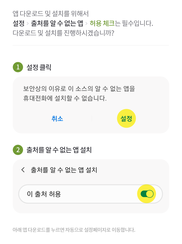
 미스토어 앱 다운로드