** Navigate Confidently, Navigate with iNavX - the world's #1 Marine Navigation App
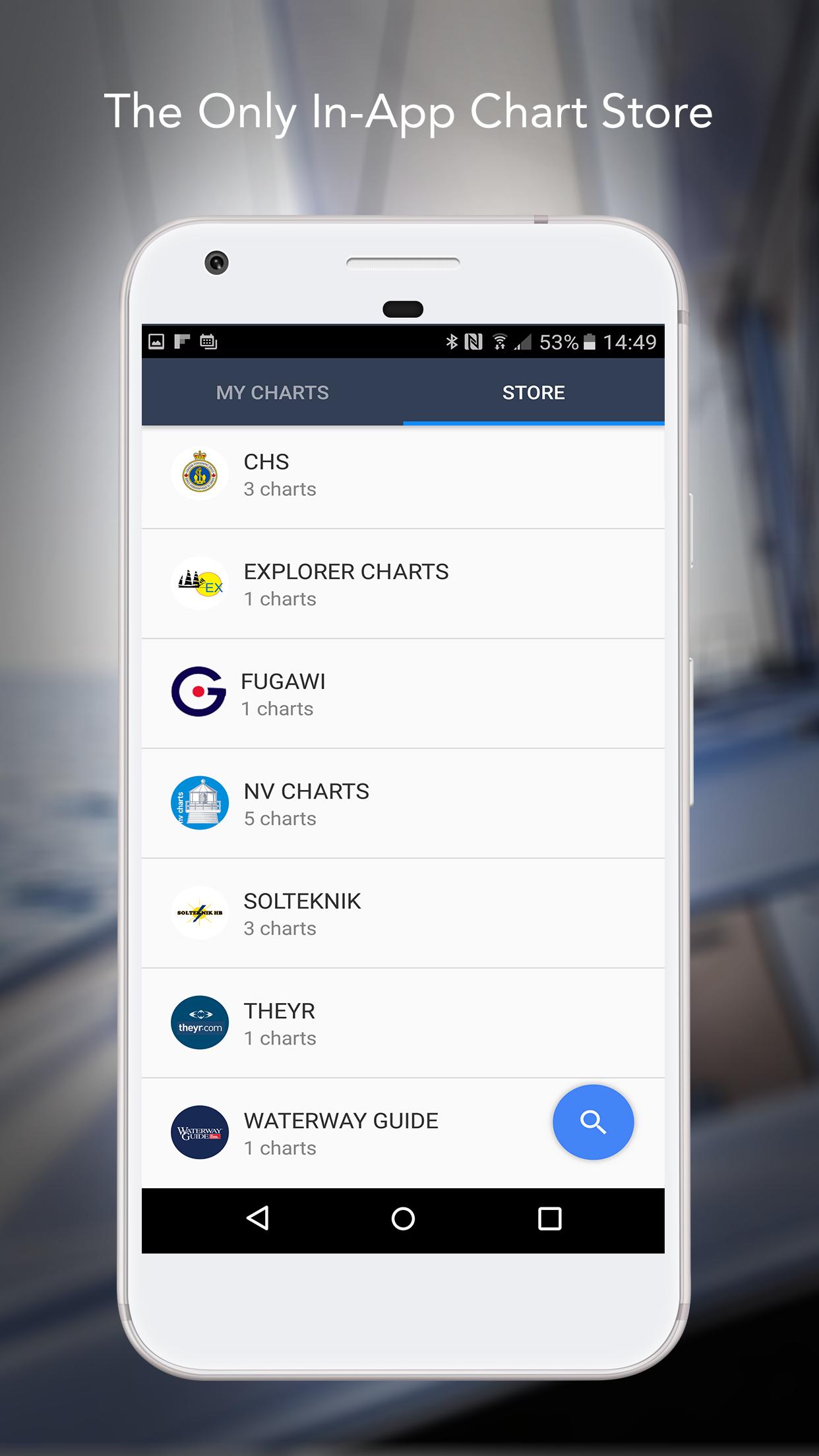
** And, the ONLY app to provide all your favorite charts from your favorite chart providers
“Editor's Choice” - Practical Sailor
"The Standard" - Cruising Magazine
"Must Have List" - Cruising World
Trusted internationally by casual and professional sailors, cruisers, boaters, fishermen, and divers.
Downloads iNavX TODAY and automatically receive a complimentary copy of the official and up-to-date high resolution NOAA RNC United States marine raster charts.
iNavX is the ONLY APP to give you access all of your favorite charts directly through the app. Fully enabled with one-touch purchase and download, iNavX gives users the most streamlined access to the broadest set of marine charts and maps from multiple providers.
• NAVIONICS
• DELIUS KLASING
• EXPLORER
• BLUE LATITUDE
• THEYR WEATHER
• WATERWAY GUIDE
• ... and more
iNavX takes handheld marine navigation to the next level.
• Anglers: Discover new fishing spots by scouting out deep holes and inlets. Locate the best fishing conditions by identifying cold fronts. Save your best fishing spots with the only app that offers unlimited markers.
• Sailors: Plan great routes with waypoint and route management. Have proactive sail management with GRIB weather forecasts. Then keep watch with integration with external AIS receivers and responders. And remember great locations by geotagging photos.
• Boaters: Stay up to date on boating conditions with weather forecasts that includes currents, winds, and swells. Then save and share great boating routes to share with the track log.
ADVANCED FEATURES - iNavX is the most feature rich app available
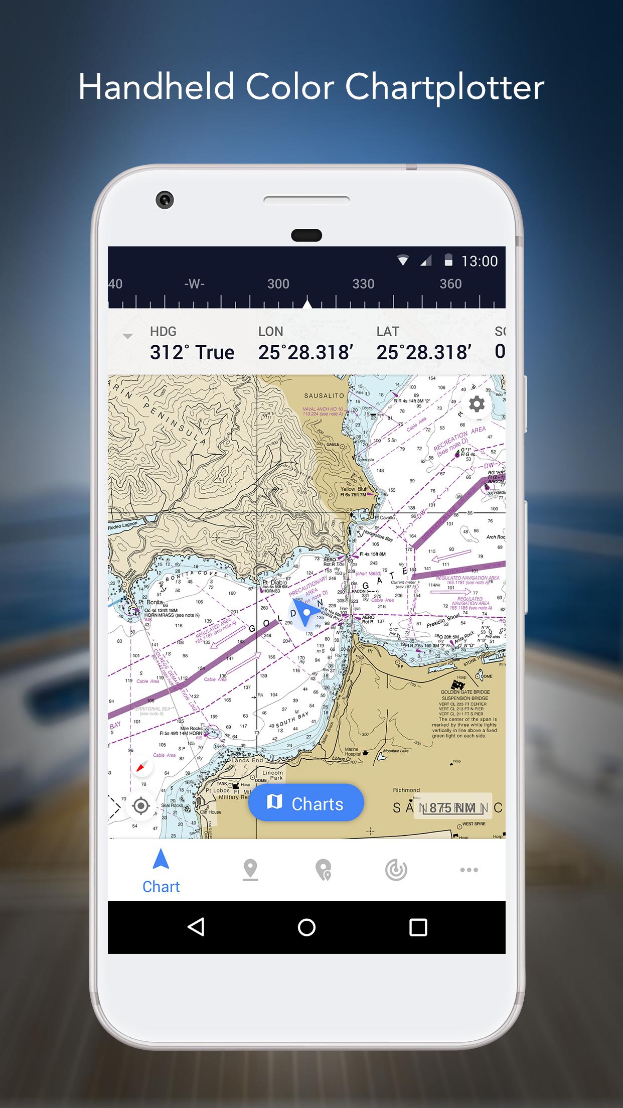
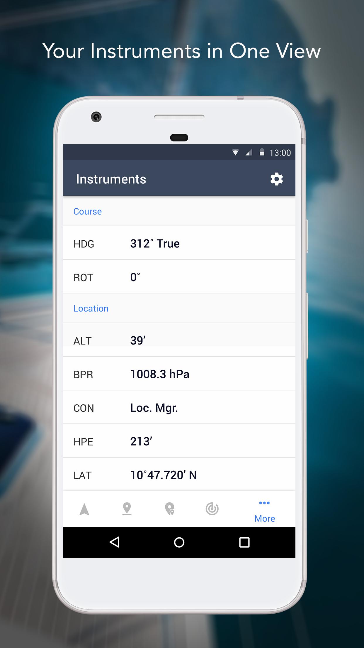
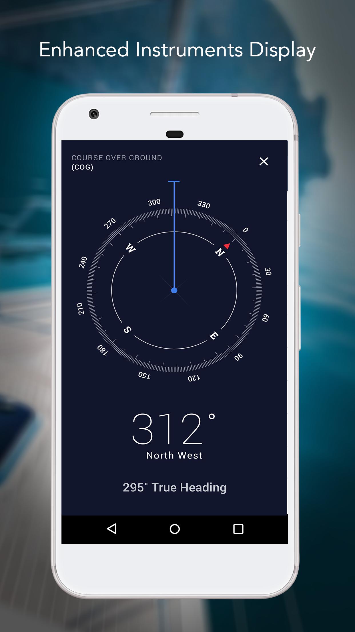
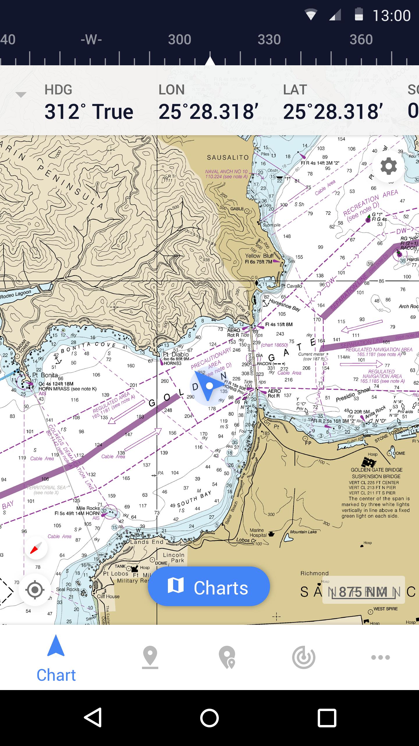
Advanced Chart Plotter
• Plot your position in real-time using your device's built-in GPS
• Easily pan, zoom, and rotate charts (including course up)
• Print a detailed chart to use in combination with the app
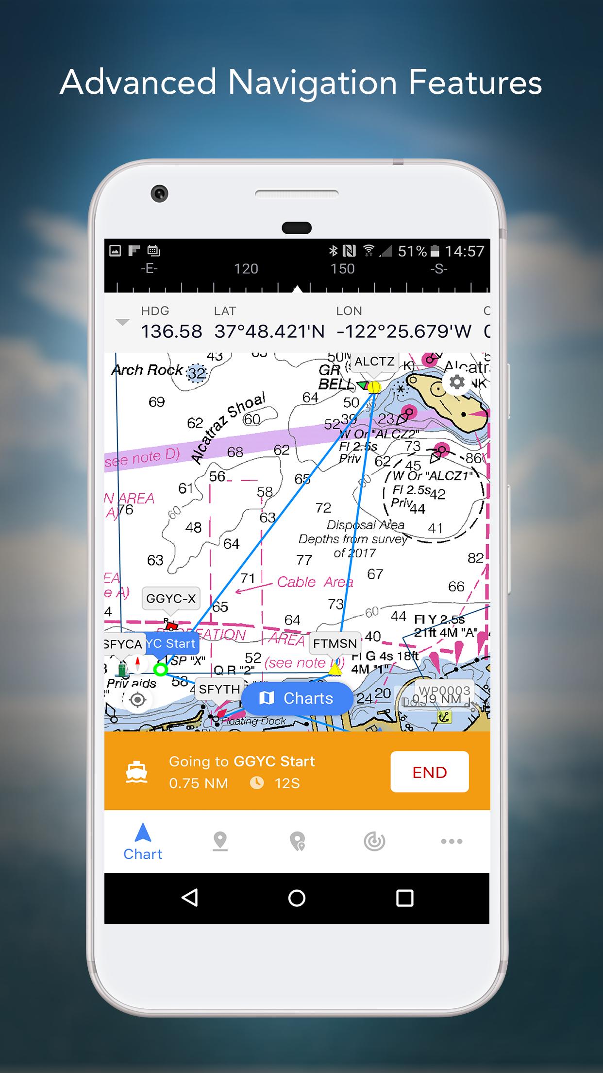
Advanced Navigation
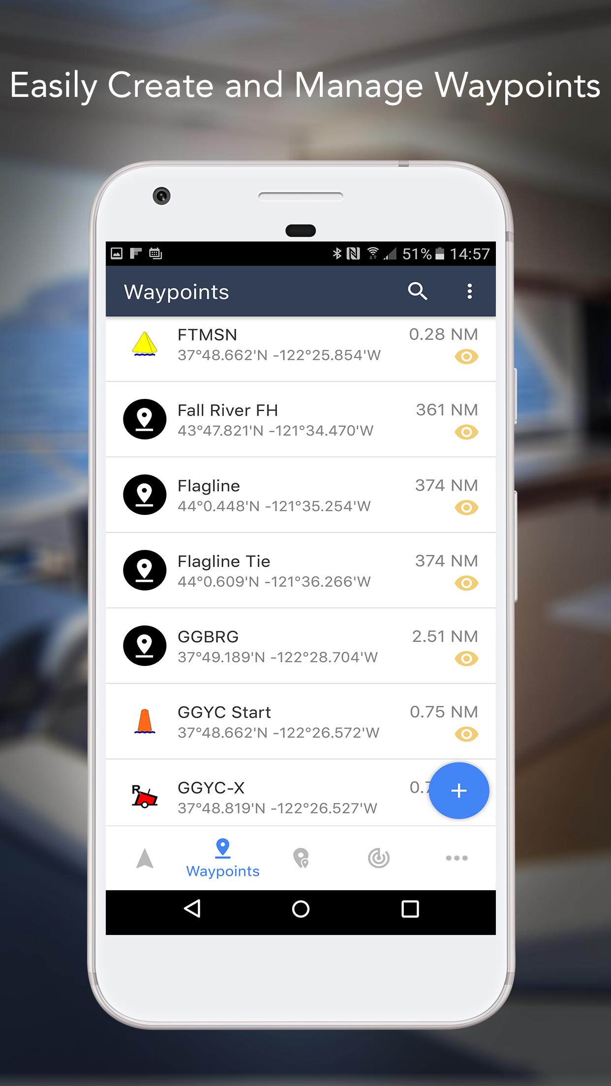
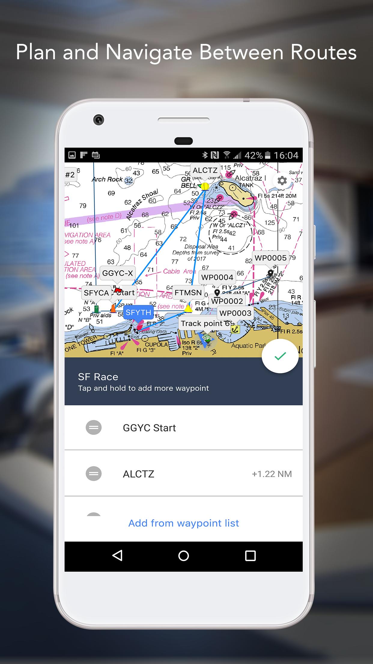
• Create waypoints and plan routes to navigate between them
• Track log allows you to record your actual route
• Import/Export data in KML (Google Earth) or GPX format
REVIEWS
“iNavX is the original and still the best navigation app.” – Practical Sailor
“The most full-featured navigation app around and viewed by many as the standard” – Sail Magazine
"The #1 recommended marine charting app" - iMarineApps


 미스토어 앱 다운로드